


Below-ground survey data for due diligence and development
What lies below the ground on a site, such as buried services, drainage runs, and below-ground infrastructure, is invisible until it becomes a problem. On a construction project, striking an unidentified service can cause delays, damage, and serious risk to operatives. In a pre-acquisition context, undisclosed drainage defects or uncharted services can affect a site's development viability, its value, and the terms on which it can be insured or funded.
BTG Eddisons provides utilities surveys and drainage surveys as part of its architectural design and survey capability, typically commissioned alongside measured surveys and other pre-development due diligence work. Both services answer distinct client questions: what buried services are present and live? What condition is the drainage infrastructure in?
Call 0800 051 2593, email [email protected], or complete our contact form further down the page to discuss your requirements.
Utilities surveys
What is a utilities survey?
A utilities survey identifies and maps the buried services present on or below a site, including water mains, gas pipes, electricity cables, telecoms ducting, and any other below-ground infrastructure.
The output is a survey drawing that shows the location, depth, and type of services identified, giving construction teams, designers, and project managers the information they need to plan groundworks safely and avoid striking live services.
Utilities surveys are produced at different levels of confidence, categorised under the internationally recognised PAS 128 standard for subsurface utility information. The appropriate level of investigation depends on the nature of the site and the risk profile of the proposed works.
When is a utilities survey needed?
A utilities survey is appropriate whenever groundworks, excavation, or below-ground construction is planned, or where the presence of buried services is relevant to a site's development potential or value. Common triggers include:
- Before construction or groundworks on a site where the location of buried services is unknown or unverified.
- As part of pre-acquisition due diligence, where the presence of services may affect the site's development viability or the cost of bringing it forward.
- Before a planning application, where a services survey may be required to support an application or inform the drainage strategy.
- For infrastructure and highway projects where existing services must be identified and accommodated in the design.

Do any of these triggers apply to your current situation?
Speak to our team today by, and we will advise you on next steps. You can get in touch when you call 0800 051 2593, email [email protected], or complete our contact form.
Drainage surveys
What is a drainage survey?
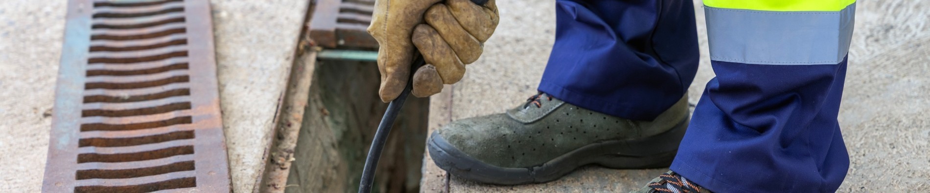
A drainage survey maps and assesses the below-ground drainage infrastructure on a site, identifying the location and layout of drainage runs, inspecting their condition, and identifying defects, blockages, or compliance issues that may affect the site's use or development. The survey is typically carried out using CCTV inspection cameras deployed through inspection chambers and manholes, supplemented by drainage tracing where the layout is unclear.
Unlike a utilities survey, which is primarily concerned with identifying what is present, a drainage survey also assesses the condition of what it finds, making it a different tool for a different client question.
When is a drainage survey needed?
- Before purchasing a site, where the condition of the drainage infrastructure is unknown and may affect the acquisition price, the scope of remediation works, or the terms of the transaction.
- As part of pre-development due diligence, where the existing drainage layout needs to be understood before a drainage strategy can be designed for a new or refurbished scheme.
- For planning submissions that require a drainage assessment or where the local planning authority requires existing drainage to be mapped before a surface water drainage strategy is agreed.
- Where a drainage issue has been identified on an existing site, such as a recurring blockage, a suspected collapse, or an unexplained wet area, and the cause needs to be established.
- For buildings where drainage compliance is relevant to insurance or regulatory obligations.
Why BTG Eddisons for utilities and drainage surveys?
-
- RICS-regulated at firm level, with survey work delivered to recognised professional standards.
- Part of BTG Eddisons' integrated architectural design and survey capability — utilities and drainage surveys can be commissioned alongside measured surveys, Land Registry plans, and fire safety and building height surveys as part of a single due diligence programme.
- Led by Nick Rymer, Director and Head of Design, with 30 years of experience across development and project delivery — utilities and drainage survey work sits naturally within the broader pre-development and pre-acquisition due diligence advice his team provides.
- National coverage through 35 offices, with survey capability across the UK.
- Over 180 years of commercial property experience, with 550 brilliant people across our national network.
- Proven track record evidenced by our case studies and client reviews.
Speak to our utilities and drainage survey team today
To discuss a utilities or drainage survey for your site, call 0800 051 2593, email [email protected], or complete the form below. Our team will advise on the right scope and approach for your instruction.
Get in touch with the BTG Eddisons team
Please contact us for more details and information.
Frequently asked questions about utilities and drainage surveys
What is PAS 128 and why does it matter for utilities surveys?
PAS 128 is the British standard for subsurface utility information. It defines four quality levels, from desktop data collection through to physical verification using detection equipment and trial holes, providing a consistent framework for specifying and reporting utilities survey work.
Specifying a PAS 128 level as part of your utilities survey instruction ensures the output meets a recognised standard and gives designers and contractors a clear basis for understanding the confidence level of the data they are working with.
Our team will advise on the appropriate quality level for your site and the proposed works.